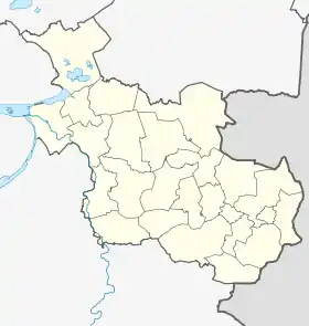
Zwartewaterland
Zwartewaterland est une commune néerlandaise, en province d'Overijssel.
| Zwartewaterland | ||||
 Héraldique. |
 Drapeau. |
|||
| Administration | ||||
|---|---|---|---|---|
| Pays | ||||
| Province | Overijssel | |||
| Code postal | 8060-8064, 8280-8299 | |||
| Indicatif téléphonique international | +(31) | |||
| Démographie | ||||
| Population | 21 956 hab. | |||
| Densité | 250 hab./km2 | |||
| Géographie | ||||
| Coordonnées | 52° 35′ 00″ nord, 6° 05′ 00″ est | |||
| Superficie | 8 791 ha = 87,91 km2 | |||
| Localisation | ||||

| ||||
| Géolocalisation sur la carte : Overijssel
Géolocalisation sur la carte : Pays-Bas
Géolocalisation sur la carte : Pays-Bas
| ||||
| Liens | ||||
| Site web | www.zwartewaterland.nl | |||
Localités
Baarlo, Cellemuiden, De Velde, Genemuiden, Hasselt, Kamperzeedijk-Oost, Kamperzeedijk-West, Kievitsnest, Mastenbroek (partiellement), Zwartewatersklooster et Zwartsluis.

Hasselt, vu depuis le pont au-dessus de la Zwarte Water.
Cet article est issu de Wikipedia. Le texte est sous licence Creative Commons - Attribution - Partage dans les Mêmes. Des conditions supplémentaires peuvent s'appliquer aux fichiers multimédias.


