Liste des lieux patrimoniaux de la péninsule d'Avalon
Cet article recense les lieux patrimoniaux de la péninsule d'Avalon (excluant Saint-Jean de Terre-Neuve) inscrits au répertoire des lieux patrimoniaux du Canada, qu'ils soient de niveau provincial, fédéral ou municipal.
Pour plus de commodité, la liste des lieux patrimoniaux de Terre-Neuve-et-Labrador est divisée par région ou municipalités locales, étant donné qu'il existe plusieurs milliers de lieux patrimoniaux à Terre-Neuve-et-Labrador. Ceci est un choix rédactionnel et non pas officiel.
Listes
- Saint-Jean de Terre-Neuve
- Péninsule d'Avalon (excluant Saint-Jean de Terre-Neuve)
- Péninsule de Bonavista
- Centre de Terre-Neuve
- Ouest de Terre-Neuve
- Labrador
| Sommaire : | Haut - A B C D E F G H I J K L M N O P Q R S T U V W X Y Z 0-9 |
|---|
| [1] | Lieu patrimonial | Illustration | Municipalité | Adresse | Coordonnées | No | Constr. | Prot.[2] | Rec. | Notes |
|---|---|---|---|---|---|---|---|---|---|---|
| P | 282 Coastal Defence Battery Registered Heritage Structure | 
|
Argentia | 47.2734 -53.9896 |
3843 | 1941 | Registered Heritage Structure | 2005 | ||
| P | Drake House Registered Heritage Structure | 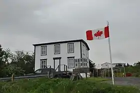 |
Arnold's Cove | 47.766 -53.9868 |
1781 | Registered Heritage Structure | 2004 | |||
| M | First Anglican Cemetery and War Memorial Site Municipal Heritage Site | 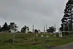 |
Arnold's Cove | 47.7574 -53.9899 |
11941 | Municipal Heritage Building, Structure or Land | 2008 | |||
| M | Salvation Army Cemetery Municipal Heritage Site | 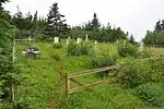 |
Arnold's Cove | 47.7559 -53.9937 |
11940 | Municipal Heritage Building, Structure or Land | 2008 | |||
| M | Second Anglican Cemetery Municipal Heritage Site |
|
Arnold's Cove | 47.7552 -53.99 |
11942 | 1915 | Municipal Heritage Building, Structure or Land | 2008 | ||
| P | Avondale Railway Station | 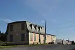 |
Avondale | 47.4074 -53.2048 |
2102 | 1880 | Registered Heritage Structure | 1988 | ||
| P | Abram Richards Property |
|
Bareneed | 47.5691 -53.2595 |
1785 | 1912 | Registered Heritage Structure | 2001 | ||
| P | Bay Bulls Harbour Provincial Historic Site |
|
Bay Bulls | 47.3125 -52.8079 |
3481 | 1696 | Provincial Historic Site | 1975 | ||
| F | Phare (Bay Bulls) |
|
Bay Bulls | 47.19 -52.44 |
9729 | 1908 | Recognized Federal Heritage Building | 1992 | ||
| M | Bay Roberts Railway Station Municipal Heritage Site |
|
Bay Roberts | 47.5946 -53.2746 |
13238 | Municipal Heritage Building, Structure or Land | 2007 | |||
| P | Bay Roberts Railway Station Registered Heritage Structure |
|
Bay Roberts | 47.5948 -53.2746 |
8003 | Registered Heritage Structure | 2007 | |||
| M | Calpin/Myers Property Municipal Heritage Site |
|
Bay Roberts | 47.5938 -53.2629 |
15370 | Municipal Heritage Building, Structure or Land | 2009 | |||
| F | Lieu historique national du Canada de l'Édifice-du-Câble |
|
Bay Roberts | Water Street | 47.5966 -53.2538 |
11970 | 1913 | National Historic Site of Canada | 2008 | |
| P | Western Union Cable Building |
|
Bay Roberts | 47.5963 -53.2544 |
2040 | 1913 | Registered Heritage Structure | 1998 | ||
| M | Western Union Cable Building Municipal Heritage Site |
|
Bay Roberts | 47.5963 -53.2544 |
13239 | 1913 | Municipal Heritage Building, Structure or Land | 2009 | ||
| P | Blundon House | 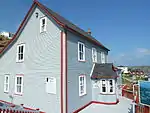 |
Bay de Verde | 48.0864 -52.8985 |
2096 | 1896 | Registered Heritage Structure | 1997 | ||
| M | Branch Cove Fossiliferous Rocks Municipal Heritage Site |
|
Branch | 46.8691 -53.9537 |
12902 | Municipal Heritage Building, Structure or Land | 2008 | |||
| M | The Hearth Municipal Heritage Site |
|
Branch | 46.88 -53.9536 |
12903 | Municipal Heritage Building, Structure or Land | 2008 | |||
| M | The Old Graveyard Municipal Heritage Site |
|
Branch | 46.8812 -53.9517 |
12904 | Municipal Heritage Building, Structure or Land | 2008 | |||
| M | The Plot Municipal Heritage Site |
|
Branch | 46.8814 -53.9516 |
12911 | Municipal Heritage Building, Structure or Land | 2008 | |||
| M | War Memorial Municipal Heritage Site |
|
Branch | 46.8817 -53.9567 |
12905 | 1980 | Municipal Heritage Building, Structure or Land | 2008 | ||
| P | Bartlett/Burke House |
|
Brigus | 47.5328 -53.2085 |
2050 | 1830 | Registered Heritage Structure | 1990 | ||
| M | Brigus Historical Zone |
|
Brigus | 47.5328 -53.2085 |
5455 | Municipal Heritage Building, Structure or Land | 1994 | |||
| F | Cottage Hawthorne | 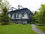 |
Brigus | north side of Irishtown Road | 47.5354 -53.2085 |
2634 | 1830 | LHN | 1978 | [3],[4] |
| F | Cottage Hawthorne | 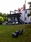 |
Brigus | Irishtown Road | 47.5352 -53.2099 |
16784 | 1830 | ÉFP classé | 1993 | [5],[4] |
| P | Fowler House | 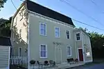 |
Brigus | 47.5378 -53.2099 |
1888 | 1850 | Registered Heritage Structure | 1988 | ||
| P | Hearn House |
|
Brigus | 47.535 -53.2113 |
2229 | 1840 | Registered Heritage Structure | 1996 | ||
| P | Joseph Bartlett House | 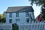 |
Brigus | 47.533 -53.2099 |
2226 | 1850 | Registered Heritage Structure | 1998 | ||
| P | Lakeview Registered Heritage Structure |
|
Brigus | 47.5337 -53.2082 |
8005 | 1872 | Registered Heritage Structure | 2007 | ||
| P | Landfall (Kent Cottage) Registered Heritage Structure | 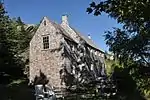 |
Brigus | 47.5423 -53.2032 |
2273 | Registered Heritage Structure | 1988 | |||
| P | St. George's Anglican Church | 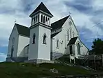 |
Brigus | 47.5365 -53.2075 |
2076 | 1877 | Registered Heritage Structure | 2004 | ||
| P | Grange de pierre | 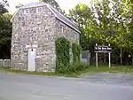 |
Brigus | 47.5355 -53.2098 |
1671 | 1825 | Structure patrimoniale répertoriée | 1986 | ||
| P | Mosquito School House |
|
Bristol's Hope | 47.7183 -53.192 |
2052 | 1828 | Registered Heritage Structure | 1988 | ||
| P | Mary Boland House Registered Heritage Structure |
|
Calvert | 47.0592 -52.9113 |
2230 | Registered Heritage Structure | 2003 | |||
| M | Immaculate Conception Cemetery Municipal Heritage Site |  |
Cape Broyle | 47.0985 -52.9414 |
5764 | Municipal Heritage Building, Structure or Land | 2006 | |||
| M | Immaculate Conception Church and Grounds Municipal Heritage Site | 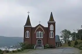 |
Cape Broyle | 47.0964 -52.9447 |
5865 | 1947 | Municipal Heritage Building, Structure or Land | 2006 | ||
| P | R.J. O'Brien's General Store | 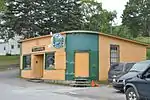 |
Cape Broyle | 47.0959 -52.9486 |
3844 | 1945 | Registered Heritage Structure | 2005 | ||
| F | Lieu historique national du Canada du Phare-du-cap-Pine | 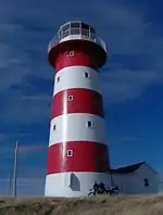 |
Cape Pine | 46.6172 -53.5326 |
10586 | 1851 | National Historic Site of Canada | 1974 | ||
| F | Lieu historique national du Canada du Phare-du-cap-Race |  |
Cape Race | 46.6587 -53.0735 |
10652 | 1907 | National Historic Site of Canada | 1974 | ||
| F | Phare de cap Race |
|
Cape Race/Cap Race | 46.6628 -53.0771 |
3627 | 1907 | Recognized Federal Heritage Building | 1990 | ||
| P | 62 Water Street | 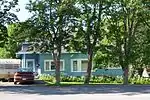 |
Carbonear | 47.7409 -53.2082 |
1993 | 1919 | Registered Heritage Structure | 1993 | ||
| F | Ancienne gare de Carbonear (Newfoundland Railway) |
|
Carbonear | 47.7332 -53.2282 |
14129 | 1918 | LHN | 1988 | ||
| P | C.N. Railway Station |
|
Carbonear | 47.7376 -53.2306 |
1975 | 1898 | Registered Heritage Structure | 1987 | ||
| M | Carbonear Railway Station Site Municipal Heritage Site |
|
Carbonear | 47.7375 -53.2294 |
12906 | Municipal Heritage Building, Structure or Land | 2008 | |||
| P | Keneally House | 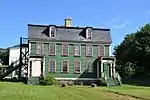 |
Carbonear | 47.739 -53.2306 |
2103 | 1849 | Registered Heritage Structure | 1988 | ||
| P | Old Carbonear Post Office | 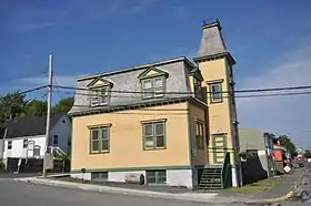 |
Carbonear | 47.7389 -53.2247 |
1851 | 1905 | Registered Heritage Structure | 1988 | ||
| P | Pinehurst | 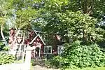 |
Carbonear | 47.7388 -53.2217 |
2073 | 1921 | Registered Heritage Structure | 2001 | ||
| P | Powell House | 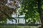 |
Carbonear | 47.7407 -53.2098 |
2053 | 1899 | Registered Heritage Structure | 1990 | ||
| P | Rorke Store | 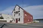 |
Carbonear | 47.7384 -53.2256 |
1881 | 1917 | Registered Heritage Structure | 1988 | ||
| P | Rorke's Stone Jug | 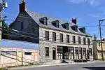 |
Carbonear | 47.7384 -53.2296 |
2143 | 1860 | Registered Heritage Structure | 1985 | ||
| P | Rural Retreat (Peach's Farm) |
|
Carbonear | 47.7475 -53.2209 |
2142 | 1833 | Registered Heritage Structure | 1985 | ||
| P | St. James Anglican Church Registered Heritage Structure | 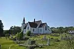 |
Carbonear | 47.7418 -53.2242 |
2041 | 1864 | Registered Heritage Structure | 2001 | ||
| P | Drogheda (Valley of Hope) |
|
Clarke's Beach | 47.5074 -53.3084 |
1897 | 1850 | Registered Heritage Structure | 1997 | ||
| P | Winter Home |  |
Clarke's Beach | 47.5415 -53.2748 |
2055 | 1919 | Registered Heritage Structure | 1995 | ||
| M | Alderdice Property Municipal Heritage Building |
|
Conception Bay South | 47.5402 -52.9299 |
2062 | 1890 | Municipal Heritage Building, Structure or Land | 2002 | ||
| M | All Saints Anglican Cemetery 1 Municipal Heritage Site |
|
Conception Bay South | 47.5143 -52.9837 |
2292 | Municipal Heritage Building, Structure or Land | 2002 | |||
| M | Butler's Store Municipal Heritage Building |
|
Conception Bay South | 47.5093 -52.9874 |
2058 | 1900 | Municipal Heritage Building, Structure or Land | 1999 | ||
| M | Chief Operator's House Municipal Heritage Building |
|
Conception Bay South | 47.4562 -53.0676 |
5935 | 1932 | Municipal Heritage Building, Structure or Land | 2002 | ||
| M | Chisholm House Municipal Heritage Site |
|
Conception Bay South | 47.5207 -52.9517 |
12927 | 1904 | Municipal Heritage Building, Structure or Land | 1999 | ||
| M | Geehan Building Municipal Heritage Building |
|
Conception Bay South | 47.5397 -52.9221 |
7468 | 1890 | Municipal Heritage Building, Structure or Land | 2007 | ||
| M | Manuels River Linear Park Municipal Heritage Site |  |
Conception Bay South | 47.5207 -52.9462 |
10638 | Municipal Heritage Building, Structure or Land | 2007 | |||
| M | Metcalfe Slaughter House and Barn, Upper Barn, Office and Shed Municipal Heritage Site |
|
Conception Bay South | 47.5255 -52.9446 |
14622 | Municipal Heritage Building, Structure or Land | 2008 | |||
| M | Miller House Municipal Heritage Site |
|
Conception Bay South | 47.5399 -52.928 |
16263 | Municipal Heritage Building, Structure or Land | 2009 | |||
| P | Morgan House |
|
Conception Bay South | 47.4565 -53.0888 |
2174 | 1870 | Registered Heritage Structure | 2000 | ||
| M | Morgan House Municipal Heritage Site |
|
Conception Bay South | 47.4564 -53.0887 |
14001 | Municipal Heritage Building, Structure or Land | 2009 | |||
| M | Prince of Orange Loyal Orange Lodge LOL 23 Municipal Heritage Building |
|
Conception Bay South | 47.505 -53.0055 |
2059 | 1875 | Municipal Heritage Building, Structure or Land | 1999 | ||
| M | St. John the Evangelist Anglican Church Municipal Heritage Site |
|
Conception Bay South | 47.5372 -52.9372 |
13716 | 1861 | Municipal Heritage Building, Structure or Land | 1999 | ||
| M | St. John the Evangelist Cemetery Municipal Heritage Site |  |
Conception Bay South | 47.5373 -52.9372 |
7466 | Municipal Heritage Building, Structure or Land | 2007 | |||
| P | St. John the Evangelist Church |  |
Conception Bay South | 47.5373 -52.9372 |
2179 | 1861 | Registered Heritage Structure | 1986 | ||
| M | St. Peter’s Anglican Church and Cemetery Municipal Heritage Site | 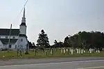 |
Conception Bay South | 47.4787 -53.0539 |
2063 | 1909 | Municipal Heritage Building, Structure or Land | 2002 | ||
| M | St. Thomas of Villa Nova Cemetery Municipal Heritage Site | 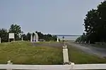 |
Conception Bay South | 47.5235 -52.9475 |
7467 | Municipal Heritage Building, Structure or Land | 2009 | |||
| M | The Herder Property Municipal Heritage Site |
|
Conception Bay South | 47.5298 -52.9579 |
13257 | 1932 | Municipal Heritage Building, Structure or Land | 2003 | ||
| M | The Hermitage Municipal Heritage Site |
|
Conception Bay South | 47.5372 -52.936 |
14002 | Municipal Heritage Building, Structure or Land | 2009 | |||
| P | The Hermitage | 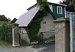 |
Conception Bay South | 47.5373 -52.9372 |
5934 | Registered Heritage Structure | 2004 | |||
| M | The Road House Municipal Heritage Site |
|
Conception Bay South | 47.5388 -52.9364 |
16264 | Municipal Heritage Building, Structure or Land | 2008 | |||
| M | Topsail United Church Cemetery | 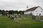 |
Conception Bay South | 2424 Conception Bay Highway | 47.5393 -52.9373 |
2291 | Municipal Heritage Building, Structure or Land | 2003 | ||
| M | Upper Gullies United Church Cemetery Municipal Heritage Site |
|
Conception Bay South | 47.4847 -53.0437 |
14683 | Municipal Heritage Building, Structure or Land | 2008 | |||
| P | Trahey Property |
|
Conception Harbour | 47.4409 -53.2075 |
2182 | 1900 | Registered Heritage Structure | 2003 | ||
| M | Bulger, A Name Rock Municipal Heritage Site |
|
Cupids | 47.5476 -53.2239 |
10851 | Municipal Heritage Building, Structure or Land | 2007 | |||
| M | Burnt Head Arch Municipal Heritage Site | 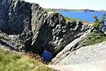 |
Cupids | 47.5692 -53.2007 |
10855 | Municipal Heritage Building, Structure or Land | 2007 | |||
| P | Butler Property | 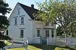 |
Cupids | 47.5611 -53.2105 |
2043 | 1905 | Registered Heritage Structure | 2001 | ||
| M | John Guy Flag Site Municipal Heritage Structure | 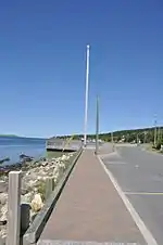 |
Cupids | 47.5478 -53.2283 |
10603 | 1910 | Municipal Heritage Building, Structure or Land | 2007 | ||
| M | Old Lighthouse Site Municipal Heritage Site | 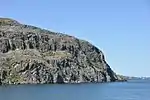 |
Cupids | 47.5549 -53.2267 |
10853 | Municipal Heritage Building, Structure or Land | 2007 | |||
| P | Lloyd George House |
|
Dildo | 47.5681 -53.5554 |
1929 | 1885 | Registered Heritage Structure | 1995 | ||
| M | Bell Rock Municipal Heritage Site |
|
Fermeuse | 46.9767 -52.9589 |
5313 | Municipal Heritage Building, Structure or Land | 2006 | |||
| M | Rock with 17th and 18th Century Graffiti Municipal Heritage Site |
|
Fermeuse | 46.9623 -52.9363 |
5962 | Municipal Heritage Building, Structure or Land | 2006 | |||
| M | Rock with 19th Century Graffiti Carvings Municipal Heritage Site |
|
Fermeuse | 46.961 -52.911 |
5967 | Municipal Heritage Building, Structure or Land | 2006 | |||
| M | St. Charles Borromeo Church and Grounds Municipal Heritage Site | 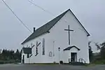 |
Fermeuse | 46.9775 -52.9587 |
5532 | 1926 | Municipal Heritage Building, Structure or Land | 2006 | ||
| M | Bernard Kavanagh Premises Municipal Heritage Site | 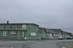 |
Ferryland | 47.0237 -52.8839 |
5456 | Municipal Heritage Building, Structure or Land | 2006 | |||
| M | Colony of Avalon Special Preservation Area Municipal Heritage District | 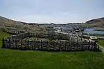 |
Ferryland | 47.0227 -52.88 |
14542 | Municipal Heritage Building, Structure or Land | 1998 | |||
| M | Ferryland Head Lighthouse Keeper's Dwelling Municipal Heritage Site | 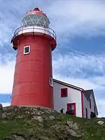 |
Ferryland | 47.0168 -52.8577 |
5534 | 1871 | Municipal Heritage Building, Structure or Land | 2006 | ||
| M | Historic Ferryland Museum Municipal Heritage Site | 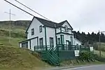 |
Ferryland | 47.0263 -52.8845 |
5533 | 1916 | Municipal Heritage Building, Structure or Land | 2006 | ||
| P | Holy Trinity Roman Catholic Church Registered Heritage Structure | 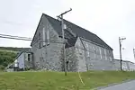 |
Ferryland | 47.0252 -52.8845 |
1939 | 1865 | Registered Heritage Structure | 1995 | ||
| M | North Side Burial Ground Municipal Heritage Site |
|
Ferryland | 47.0314 -52.8834 |
12907 | Municipal Heritage Building, Structure or Land | 2008 | |||
| M | South Side Burial Ground Municipal Heritage Site |
|
Ferryland | 47.0236 -52.8856 |
12908 | Municipal Heritage Building, Structure or Land | 2008 | |||
| M | The Downs Historic Conservation Area |  |
Ferryland | 47.019 -52.8613 |
6119 | Municipal Heritage Building, Structure or Land | 1998 | |||
| F | Phare de Ferryland Head |
|
Ferryland Head | 47.0163 -52.8593 |
4728 | 1871 | Recognized Federal Heritage Building | 1991 | ||
| M | Blessing of the Fleet and Homily Site |  |
Flatrock | 47.705 -52.7102 |
4438 | 1985 | Municipal Heritage Building, Structure or Land | 2005 | ||
| M | Our Lady of Lourdes Grotto | 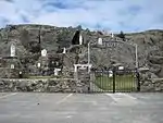 |
Flatrock | 47.705 -52.7133 |
4502 | 1958 | Municipal Heritage Building, Structure or Land | 2005 | ||
| P | Davis House | 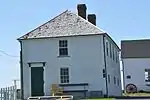 |
Freshwater | 47.7567 -53.1844 |
1886 | 1850 | Registered Heritage Structure | 1989 | ||
| F | Lieu historique national du Canada du Paysage-des-Murs-de-Grates Cove | 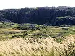 |
Grates Cove | 48.1667 -52.9333 |
12745 | 2009 | National Historic Site of Canada | 1995 | ||
| P | Loyal Orange Lodge LOL 9 |
|
Green's Harbour | 47.6331 -53.51 |
2198 | 1898 | Registered Heritage Structure | 1995 | ||
| F | Tour de phare |
|
Gull Island | 49.9983 -55.3592 |
3906 | 1884 | Recognized Federal Heritage Building | 1989 | ||
| P | Custard Head Fishing Premises | 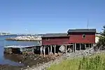 |
Hant's Harbour | 48.0155 -53.2592 |
2199 | 1905 | Registered Heritage Structure | 1999 | ||
| P | Cathedral of Immaculate Conception | 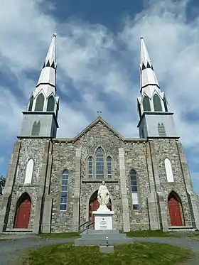 |
Harbour Grace | 47.6956 -53.2113 |
2326 | 1899 | Registered Heritage Structure | 1990 | ||
| P | Goodland House | 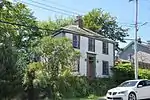 |
Harbour Grace | 47.6912 -53.2232 |
1996 | 1850 | Registered Heritage Structure | 1995 | ||
| M | Gordon G. Pike Railway Heritage Museum and Park | 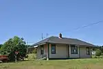 |
Harbour Grace | 47.6958 -53.2184 |
4184 | 1884 | Municipal Heritage Building, Structure or Land | 2006 | ||
| M | Harbour Grace Fire Bell |
|
Harbour Grace | 47.6903 -53.2208 |
4185 | Municipal Heritage Building, Structure or Land | 2006 | |||
| P | Harbour Grace Registered Heritage District | 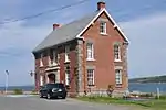 |
Harbour Grace | 47.693 -53.2123 |
2381 | 1890 | Registered Heritage District | 1992 | ||
| F | Lieu historique national du Canada du Palais-de-Justice-de-Harbour Grace | 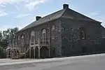 |
Harbour Grace | 2 Harvey Street | 47.6833 -53.2625 |
7537 | 1830 | National Historic Site of Canada | 1966 | |
| M | Masonic Lodge Harbour Grace 476 A.F. and A.M., S.C | 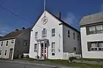 |
Harbour Grace | 47.6914 -53.2224 |
4189 | Municipal Heritage Building, Structure or Land | 2006 | |||
| M | Otterbury School House | 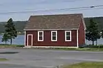 |
Harbour Grace | 47.6763 -53.2502 |
4191 | Municipal Heritage Building, Structure or Land | 2006 | |||
| P | Payne House | 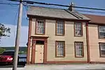 |
Harbour Grace | 47.6896 -53.2252 |
1997 | 1856 | Registered Heritage Structure | 1999 | ||
| P | Ridley Hall Ruins Registered Heritage Structure |  |
Harbour Grace | 47.6927 -53.2153 |
8582 | Registered Heritage Structure | 1994 | |||
| P | Ridley Office | 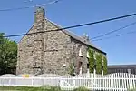 |
Harbour Grace | 47.6913 -53.2166 |
2317 | 1838 | Registered Heritage Structure | 1990 | ||
| M | Roman Catholic Parish Cemetery | 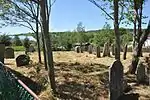 |
Harbour Grace | 47.6924 -53.2177 |
4190 | Municipal Heritage Building, Structure or Land | 2006 | |||
| P | Rothesay House, Munn/Godden Residence | 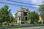 |
Harbour Grace | 47.6937 -53.2127 |
3305 | 1906 | Registered Heritage Structure | 2005 | ||
| P | St. Paul's Anglican Church | 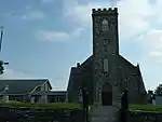 |
Harbour Grace | 47.6956 -53.2173 |
2144 | 1835 | Registered Heritage Structure | 1995 | ||
| M | The Maples | 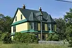 |
Harbour Grace | 47.6927 -53.2153 |
4192 | 1900 | Municipal Heritage Building, Structure or Land | 2006 | ||
| P | Victoria Manor | 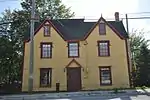 |
Harbour Grace | 47.6921 -53.224 |
2044 | 1830 | Registered Heritage Structure | 1995 | ||
| P | West End Mercantile Establishment | 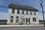 |
Harbour Grace | 47.6896 -53.2252 |
3081 | 1853 | Registered Heritage Structure | 2005 | ||
| P | Cable Staff House 1 | 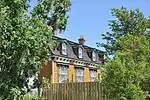 |
Heart's Content | 47.8735 -53.3675 |
2225 | 1888 | Registered Heritage Structure | 1995 | ||
| P | Cable Staff House 2 | |
Heart's Content | 47.8735 -53.3675 |
2224 | 1888 | Registered Heritage Structure | 1995 | ||
| P | Heart's Content Cable Station | 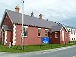 |
Heart's Content | 47.8728 -53.3696 |
3057 | 1876 | Provincial Historic Site | 1974 | ||
| M | Heyfield Memorial United Church and Cemetery Municipal Heritage Site | 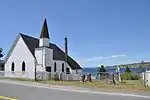 |
Heart's Content | 47.8955 -53.3681 |
7307 | 1878 | Municipal Heritage Building, Structure or Land | 2007 | ||
| F | Phare (Heart's Content) |
|
Heart's Content | 47.8822 -53.385 |
3975 | 1901 | Recognized Federal Heritage Building | 1990 | ||
| P | Society of United Fishermen Lodge SUF 1 | 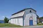 |
Heart's Content | 47.875 -53.3698 |
2202 | 1869 | Registered Heritage Structure | 1993 | ||
| P | Reid's General Store |
|
Heart's Delight-Islington | 47.771 -53.465 |
2227 | Registered Heritage Structure | 2003 | |||
| M | Chapel Cemetery Municipal Heritage Site |
|
Holyrood | 47.655 -52.7259 |
10190 | Municipal Heritage Building, Structure or Land | 2008 | |||
| M | Fjordheim Property Municipal Heritage Site |
|
Holyrood | 47.3952 -53.1199 |
10192 | 1934 | Municipal Heritage Building, Structure or Land | 2008 | ||
| M | Lulah-Oh! / Carroll Property Municipal Heritage Site | 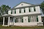 |
Holyrood | 47.3887 -53.1363 |
8371 | Municipal Heritage Building, Structure or Land | 2007 | |||
| M | Veitch Property Municipal Heritage Site |
|
Holyrood | 47.3872 -53.136 |
10193 | Municipal Heritage Building, Structure or Land | 2008 | |||
| P | Shano/Le Shane Property Registered Heritage Structure |  |
Lower Island Cove | 48.0086 -52.9754 |
6246 | 1860 | Registered Heritage Structure | 2006 | ||
| P | Markland Cottage Hospital Registered Heritage Structure |
|
Markland | 47.4027 -53.5448 |
7784 | 1935 | Registered Heritage Structure | 2007 | ||
| M | Admiralty House Museum and Archives |
|
Mount Pearl | 47.5053 -52.7961 |
2019 | 1915 | City of Mount Pearl Heritage Building, Structure or Land | 1990 | ||
| M | Burrage’s Stage Municipal Heritage Site |
|
New Perlican | 47.9102 -53.3588 |
15372 | 1962 | Municipal Heritage Building, Structure or Land | 2009 | ||
| M | Sittin' Rock Municipal Heritage Site |
|
New Perlican | 47.9041 -53.357 |
14003 | Municipal Heritage Building, Structure or Land | 2008 | |||
| M | St. Matthew's United Church Southside Cemetery Municipal Heritage Site |
|
New Perlican | 47.911 -53.3567 |
14004 | Municipal Heritage Building, Structure or Land | 2008 | |||
| M | Town of New Perlican Heritage Conservation Zone Municipal Heritage District |  |
New Perlican | 47.908 -53.358 |
8148 | Municipal Heritage Building, Structure or Land | 2002 | |||
| M | Waterloo Loyal Orange Lodge No. 18 Municipal Heritage Site |
|
New Perlican | 47.9084 -53.358 |
14413 | 1931 | Municipal Heritage Building, Structure or Land | 2009 | ||
| P | Aubrey and Elizabeth Crowley Property |  |
Ochre Pit Cove | 47.9092 -53.0667 |
1901 | 1915 | Registered Heritage Structure | 2001 | ||
| P | Beckett Property |  |
Old Perlican | 48.0831 -53.0063 |
1928 | 1902 | Registered Heritage Structure | 2001 | ||
| M | John Parot's Grave Municipal Heritage Site |
|
Old Perlican | à géolocaliser | 5668 | Municipal Heritage Building, Structure or Land | 2000 | |||
| P | Petty Harbour Hydro-Electric Generating Station | 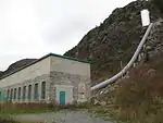 |
Petty Harbour | 47.4652 -52.7119 |
4326 | 1900 | Registered Historic Site | 1985 | ||
| M | Anglo American Telegraph Building Municipal Heritage Building | 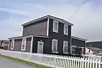 |
Placentia | 47.2474 -53.9611 |
6249 | 1876 | Municipal Heritage Building, Structure or Land | 2006 | ||
| P | Anglo American Telegraph Company Cable Office Registered Heritage Structure |
|
Placentia | 47.2474 -53.9611 |
3845 | 1876 | Registered Heritage Structure | 2005 | ||
| M | Argentia 282 Coastal Defence Battery Municipal Heritage Site |
|
Placentia | 47.2734 -53.9896 |
6122 | 1941 | Municipal Heritage Building, Structure or Land | 2006 | ||
| M | Fort Frederick |  |
Placentia | 47.2492 -53.9618 |
4067 | 1717 | Municipal Heritage Building, Structure or Land | 1972 | ||
| F | Lieu historique national du Canada de Castle Hill | 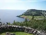 |
Placentia | Route 100 | 47.2513 -53.9722 |
7565 | 1762 | National Historic Site of Canada | 1968 | |
| M | O'Reilly House Municipal Heritage Building | 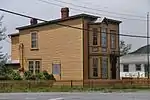 |
Placentia | à géolocaliser | 6120 | 1902 | Municipal Heritage Building, Structure or Land | 2006 | ||
| P | O'Reilly House Registered Heritage Structure |
|
Placentia | à géolocaliser | 2233 | 1902 | Registered Heritage Structure | 1999 | ||
| M | Our Lady of Angels / Presentation Convent Municipal Heritage Building | 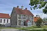 |
Placentia | 47.2441 -53.9615 |
6248 | 1864 | Municipal Heritage Building, Structure or Land | 2006 | ||
| P | Our Lady of Angels / Presentation Convent Registered Heritage Structure |
|
Placentia | 47.2441 -53.9615 |
2234 | 1864 | Registered Heritage Structure | 1991 | ||
| P | St. Luke's Anglican Church |
|
Placentia | 47.2462 -53.9616 |
2327 | 1908 | Registered Heritage Structure | 2000 | ||
| M | St. Luke's Anglican Church Municipal Heritage Building | 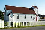 |
Placentia | 47.2462 -53.9616 |
6247 | 1908 | Municipal Heritage Building, Structure or Land | 2006 | ||
| M | Wakeham Sawmill Municipal Heritage Building | 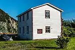 |
Placentia | 47.2456 -53.9586 |
6123 | 1912 | Municipal Heritage Building, Structure or Land | 2006 | ||
| P | Wakeham Sawmill Registered Heritage Structure |
|
Placentia | 47.2456 -53.9586 |
4041 | 1912 | Registered Heritage Structure | 2005 | ||
| P | Porter House |
|
Port de Grave | 47.6006 -53.185 |
2042 | 1904 | Registered Heritage Structure | 1999 | ||
| M | Mother M. Bernard Kirwan Memorial Municipal Heritage Site | 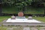 |
Port Kirwan | 46.9694 -52.9095 |
7278 | Municipal Heritage Building, Structure or Land | 2007 | |||
| M | Old Cemetery Municipal Heritage Site |  |
Port Kirwan | 46.9707 -52.9098 |
5050 | Municipal Heritage Building, Structure or Land | 2006 | |||
| P | White House |
|
Portugal Cove | 47.6225 -52.8606 |
3842 | Registered Heritage Structure | 1992 | |||
| M | West Point Cemetery Municipal Heritage Site |
|
Portugal Cove-St. Philip's | 47.6234 -52.8662 |
12064 | Municipal Heritage Building, Structure or Land | 2008 | |||
| M | Devil's Rock |
|
Renews-Cappahayden | 46.9329 -52.9451 |
4435 | Municipal Heritage Building, Structure or Land | 2005 | |||
| P | Holy Apostles Church | 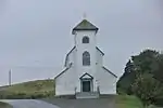 |
Renews-Cappahayden | 46.9282 -52.9113 |
2110 | 1877 | Registered Heritage Structure | 1993 | ||
| M | Midnight Hill and Grotto de Lourdes on Mass Rock Municipal Heritage Site | 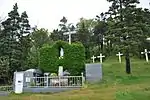 |
Renews-Cappahayden | 46.9287 -52.9327 |
4683 | 1928 | Municipal Heritage Building, Structure or Land | 2005 | ||
| M | Old Cemetery |  |
Renews-Cappahayden | 46.9235 -52.9311 |
4437 | Municipal Heritage Building, Structure or Land | 2005 | |||
| M | Presentation Cemetery Municipal Heritage Site | 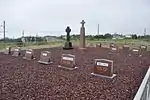 |
Renews-Cappahayden | 46.9287 -52.9336 |
5051 | Municipal Heritage Building, Structure or Land | 2006 | |||
| M | Presentation Convent Grounds Municipal Heritage Site | 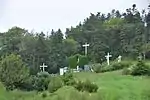 |
Renews-Cappahayden | 46.9285 -52.9331 |
5385 | Municipal Heritage Building, Structure or Land | 2006 | |||
| M | Paddy Miller House Municipal Heritage Building |
|
Southern Harbour | 47.709 -53.97 |
8146 | Municipal Heritage Building, Structure or Land | 2004 | |||
| P | Mark Gosse Residence | 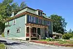 |
Spaniard's Bay | 47.6083 -53.2858 |
2039 | 1901 | Registered Heritage Structure | 2004 | ||
| M | Spaniard's Bay United Church Municipal Heritage Site |
|
Spaniard's Bay | 47.6209 -53.2764 |
6192 | 1894 | Municipal Heritage Building, Structure or Land | 2006 | ||
| P | Spaniard's Bay United Church Registered Heritage Structure |
|
Spaniard's Bay | 47.6209 -53.2764 |
7783 | 1894 | Registered Heritage Structure | 2007 | ||
| F | Phare du cap St. Mary's |
|
St. Bride's | 46.8231 -54.196 |
13042 | 1860 | Recognized Federal Heritage Building | 2007 | ||
| M | Women’s Patriotic Association War Memorial Municipal Heritage Site |  |
Sunnyside | 47.8583 -53.9221 |
7465 | Municipal Heritage Building, Structure or Land | 2006 | |||
| M | Codner House and Shed |
|
Torbay | 47.66 -52.7325 |
4492 | Municipal Heritage Building, Structure or Land | 2005 | |||
| M | Old Holy Trinity Parish Cemetery Municipal Heritage Site |
|
Torbay | 47.6547 -52.7259 |
8243 | Municipal Heritage Building, Structure or Land | 2007 | |||
| M | Old St. Nicholas Anglican Cemetery Municipal Heritage Site |
|
Torbay | 47.66 -52.7315 |
8147 | Municipal Heritage Building, Structure or Land | 2007 | |||
| P | Victoria Hydro-Electric Generating Station |
|
Victoria | VictoriaNL_HydroStation.jpg | 47.7752 -53.2154 |
4327 | 1904 | Registered Historic Site | 1985 | |
| P | Bell Island No. 2 Mine Registered Heritage Structure |
|
Wabana | 47.6465 -52.9473 |
6245 | Registered Heritage Structure | 2006 | |||
| P | Somerton Property |
|
Wabana | 47.6465 -52.9465 |
1866 | 1930 | Registered Heritage Structure | 2003 | ||
| P | Western Bay Railway Station | 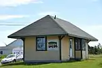 |
Western Bay | 47.8802 -53.0869 |
2067 | 1914 | Registered Heritage Structure | 1994 | ||
| M | Burgess Fishing Property Municipal Heritage Building |
|
Whiteway | 47.6809 -53.4867 |
5467 | 1900 | Municipal Heritage Building, Structure or Land | 2006 | ||
| P | Holy Trinity Convent and Chapel Registered Heritage Structure | 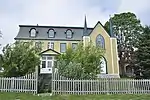 |
Witless Bay | 47.2811 -52.8314 |
3761 | Registered Heritage Structure | 2005 | |||
| M | Old Witless Bay Cemetery |
|
Witless Bay | 47.2798 -52.822 |
5052 | Municipal Heritage Building, Structure or Land | 2006 |
Notes et références
- Niveau de la désignation: F: Fédéral, P: Provincial, M: Municipal
- (fr) Répertoire canadien des lieux patrimoniaux : Manuel de normes de documentation, Annexe A : Vocabulaires contrôlés, p.59-78
(en) Canadian Register of Historic Places: Documentation Standards Handbook, Appendix A: Controlled Vocabulary, p.57-75 - Classé édifice fédéral du patrimoine en 1993 (Cottage Hawthorne)
- situé dans la Brigus Historical Zone
- Désigné lieu historique national en 1978 (Cottage Hawthorne)
Annexes
Liens externes
- « Lieux patrimoniaux du Canada »
- « Annuaire des désignations patrimoniales fédérales », sur Parcs Canada
- (en) « Property Search », sur Heritage Foundation of Newfoundland and Labrador
 Portail de Terre-Neuve-et-Labrador
  Portail des lieux patrimoniaux du Canada
Cet article est issu de Wikipedia. Le texte est sous licence Creative Commons - Attribution - Partage dans les Mêmes. Des conditions supplémentaires peuvent s'appliquer aux fichiers multimédias.