Liste des lieux patrimoniaux de l'Ouest de Terre-Neuve
Cet article recense les lieux patrimoniaux de l'ouest de Terre-Neuve inscrits au répertoire des lieux patrimoniaux du Canada, qu'ils soient de niveau provincial, fédéral ou municipal.
Pour plus de commodité, la liste des lieux patrimoniaux de Terre-Neuve-et-Labrador est divisée par région ou municipalités locales, étant donné qu'il existe plusieurs milliers de lieux patrimoniaux à Terre-Neuve-et-Labrador. Ceci est un choix rédactionnel et non pas officiel.
Listes
- Saint-Jean de Terre-Neuve
- Péninsule d'Avalon (excluant Saint-Jean de Terre-Neuve)
- Péninsule de Bonavista
- Centre de Terre-Neuve
- Ouest de Terre-Neuve
- Labrador
| Sommaire : | Haut - A B C D E F G H I J K L M N O P Q R S T U V W X Y Z 0-9 |
|---|
| [1] | Lieu patrimonial | Illustration | Municipalité | Adresse | Coordonnées | No | Constr. | Prot.[2] | Rec. | Notes |
|---|---|---|---|---|---|---|---|---|---|---|
| M | Old Anglican Cemetery | 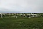 |
Anchor Point | 51.2348 -56.7994 |
8060 | Municipal Heritage Building, Structure or Land | 2007 | |||
| P | John Rodway Senior Residence | 
|
Baine Harbour | 47.3603 -54.8886 |
2628 | 1899 | Registered Heritage Structure | 2002 | ||
| F | Résidence du gardien |
|
Belle Isle | 51.8828 -55.3861 |
3629 | 1856 | Recognized Federal Heritage Building | 1990 | ||
| F | Tour de phare |
|
Belle Isle | 51.9989 -55.2891 |
3904 | 1905 | Recognized Federal Heritage Building | 1989 | ||
| F | Édifice fédéral du patrimoine reconnu Feu supérieur |
|
Belle Isle | 51.8828 -55.3861 |
3905 | 1858 | Recognized Federal Heritage Building | 1990 | ||
| P | Quirpon Island Lightkeeper's Residence |
|
Cap Bauld | 51.64 -55.4278 |
3182 | 1920 | Registered Heritage Structure | 2004 | ||
| P | Adams Home | 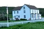 |
Cape Onion | 51.61 -55.6254 |
1895 | 1899 | Registered Heritage Structure | 1989 | ||
| P | Holy Trinity Anglican Church Registered Heritage Structure | 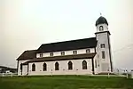 |
Codroy | 47.8552 -59.2703 |
1947 | 1913 | Registered Heritage Structure | 1993 | ||
| F | Phare du cap Anguille | 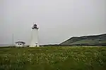 |
Codroy | 47.8983 -59.4108 |
13089 | 1960 | Recognized Federal Heritage Building | 2007 | ||
| M | 1942 Plane Crash Municipal Heritage Site |
|
Conche | 50.8828 -55.8931 |
11949 | Municipal Heritage Building, Structure or Land | 2007 | |||
| M | Captain Coubelongue Grave Site Municipal Heritage Site |
|
Conche | 50.9021 -55.8885 |
11945 | Municipal Heritage Building, Structure or Land | 2007 | |||
| P | Casey Store |
|
Conche | 50.8942 -55.8981 |
2034 | 1904 | Registered Heritage Structure | 2001 | ||
| M | Casey Store and House Municipal Heritage Site |
|
Conche | 50.8942 -55.8981 |
11947 | 1904 | Municipal Heritage Building, Structure or Land | 2007 | ||
| P | Martinique Bay Provincial Historic Site |
|
Conche | 50.9008 -55.8997 |
3083 | 1707 | Provincial Historic Site | 1977 | ||
| M | The Quidnock Municipal Heritage Site |
|
Conche | 50.8835 -55.8968 |
11948 | Municipal Heritage Building, Structure or Land | 2007 | |||
| P | William and Cecilia O'Neill Property |
|
Conche | 50.8934 -55.8985 |
2183 | 1909 | Registered Heritage Structure | 2001 | ||
| M | William and Cecilia O'Neill Property Municipal Heritage Site |
|
Conche | 50.8936 -55.8986 |
11946 | 1909 | Municipal Heritage Building, Structure or Land | 2007 | ||
| P | 067 Central Street | 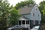 |
Corner Brook | 48.9513 -57.9328 |
2341 | 1925 | Registered Heritage Structure | 2002 | ||
| P | Bank of Montreal |
|
Corner Brook | 48.9581 -57.9946 |
2340 | 1915 | Registered Heritage Structure | 2001 | ||
| P | Corner Brook Public Building | 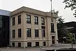 |
Corner Brook | 48.9529 -57.9448 |
2342 | 1926 | Registered Heritage Structure | 2001 | ||
| P | Glynmill Inn | 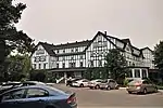 |
Corner Brook | 48.9488 -57.9398 |
8579 | 1923 | Registered Heritage Structure | 2001 | ||
| P | Julius Swirsky Clothing Stor | 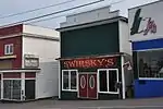 |
Corner Brook | 48.9516 -57.9515 |
10843 | Registered Heritage Structure | 2008 | |||
| M | Cow Head Light | 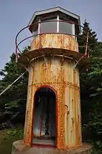 |
Cow Head | 49.9198 -57.8137 |
3840 | 1909 | Municipal Heritage Building, Structure or Land | 2003 | ||
| M | Dr. Henry N. Payne Community Museum | 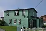 |
Cow Head | 49.913 -57.7948 |
3841 | 1941 | Municipal Heritage Building, Structure or Land | 2003 | ||
| M | Gravesite of Cow Head's First Settlers |
|
Cow Head | 49.9224 -57.8081 |
4033 | Municipal Heritage Building, Structure or Land | 2003 | |||
| M | Old Anglican Cemetery | 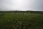 |
Cow Head | 49.9212 -57.8066 |
4034 | Municipal Heritage Building, Structure or Land | 2003 | |||
| P | Long Point Light Station Dwelling | 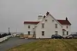 |
Crow Head | 49.6878 -54.8002 |
6407 | 1876 | Registered Heritage Structure | 2006 | ||
| M | Long Point Lightstation Municipal Heritage Site | 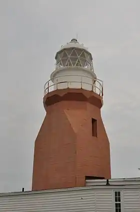 |
Crow Head | 49.6878 -54.8002 |
5994 | 1876 | Municipal Heritage Building, Structure or Land | 2004 | ||
| P | Nurse Myra Bennett House Registered Heritage Structure |  |
Daniel's Harbour | 50.2333 -57.5833 |
2186 | 1924 | Registered Heritage Structure | 1991 | ||
| P | International Pulp and Paper Company Staff House |  |
Deer Lake | 49.1705 -57.4325 |
2181 | 1924 | Registered Heritage Structure | 2002 | ||
| F | Tour de phare |  |
Ferolle Point | 51.0206 -57.0936 |
3619 | 1914 | Recognized Federal Heritage Building | 1989 | ||
| P | St. Barnabas Anglican Church |  |
Flower's Cove | 51.2968 -56.7336 |
2105 | 1921 | Registered Heritage Structure | 1997 | ||
| M | Stanley Ford Home and Outbuildings Municipal Heritage Site |
|
Jackson's Arm | 49.8656 -56.7957 |
5381 | Municipal Heritage Building, Structure or Land | 2006 | |||
| M | Wicks Store Municipal Heritage Site |
|
Jackson's Arm | 49.865 -56.773 |
5870 | 1926 | Municipal Heritage Building, Structure or Land | 2006 | ||
| P | Hulan House |
|
Jeffrey's | 48.2333 -58.845 |
2091 | 1866 | Registered Heritage Structure | 1991 | ||
| M | Lourdes Land Settlement Site | 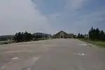 |
Lourdes | 48.6483 -58.9971 |
8009 | Municipal Heritage Building, Structure or Land | 2007 | |||
| M | Bonne Bay Cottage Hospital Municipal Heritage Building | 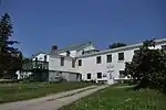 |
Norris Point | 49.5382 -57.8824 |
5262 | 1940 | Municipal Heritage Building, Structure or Land | 2003 | ||
| M | Jenniex House | 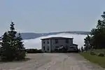 |
Norris Point | 49.5244 -57.8849 |
8142 | 1926 | Municipal Heritage Building, Structure or Land | 2006 | ||
| F | Lieu historique national du Canada de Port au Choix | Port au Choix | 50.7088 -57.3796 |
11464 | National Historic Site of Canada | 1970 | ||||
| F | Phare (Port au Choix) |
|
Port au Choix | 50.6977 -57.4066 |
9731 | 1892 | Recognized Federal Heritage Building | 1991 | ||
| P | Our Lady of Mercy Church Registered Heritage Structure | 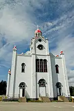 |
Port au Port | 48.55 -58.7667 |
2280 | 1925 | Registered Heritage Structure | 1997 | ||
| P | William Henry Pynn House |
|
Quirpon | 51.5803 -55.4333 |
2094 | 1892 | Registered Heritage Structure | 2001 | ||
| F | Phare du cap Bauld |
|
Île Quirpon | 51.6391 -55.4282 |
13014 | 1961 | Recognized Federal Heritage Building | 2007 | ||
| P | Precious Blood Church and Bell House | 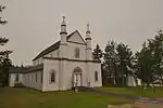 |
St. Andrew's | 47.7764 -59.28 |
2238 | 1912 | Registered Heritage Structure | 2001 | ||
| M | East Side Interdenominational Cemetery |  |
St. Anthony | 51.364 -55.569 |
10191 | Municipal Heritage Building, Structure or Land | 2008 | |||
| P | Grenfell House | 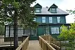 |
St. Anthony | 51.3667 -55.5833 |
2324 | 1909 | Registered Heritage Structure | 1986 | ||
| F | Lieu historique national du Canada de L'Anse aux Meadows |  |
St. Anthony | 11 km au nord de Saint-Luniare | 51.5984 -55.5618 |
4219 | National Historic Site of Canada | 1968 | ||
| M | The Grenfell Plaques | 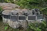 |
St. Anthony | 51.3667 -55.5833 |
10171 | Municipal Heritage Building, Structure or Land | 2008 | |||
| M | War Memorial (St. Anthony) | 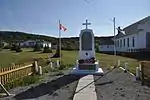 |
St. Anthony | 51.3607 -55.5818 |
8334 | 1959 | Municipal Heritage Building, Structure or Land | 2007 | ||
| P | Arnold Morris House |
|
St. George's | 48.4333 -58.4803 |
2281 | 1909 | Registered Heritage Structure | 1998 | ||
| P | St. George's Courthouse Registered Heritage Structure | 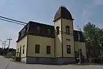 |
St. George's | 48.4333 -58.4803 |
2111 | 1906 | Registered Heritage Structure | 2001 | ||
| P | St. Joseph's Roman Catholic Church |  |
St. George's | 48.4334 -58.4803 |
2241 | 1904 | Registered Heritage Structure | 2000 | ||
| M | Old Anglican Cemetery Municipal Heritage Site |
|
St. Pauls | 49.8588 -57.8218 |
12917 | Municipal Heritage Building, Structure or Land | 2008 | |||
| M | Old Roman Catholic Cemetery Municipal Heritage Site |
|
St. Pauls | 49.8568 -57.8195 |
12920 | Municipal Heritage Building, Structure or Land | 2008 | |||
| P | Jacob A. Crocker House | 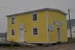 |
Trout River | 49.4809 -58.1277 |
2176 | 1898 | Registered Heritage Structure | 2003 | ||
| M | Blanchard House | 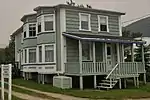 |
Woody Point | 49.5046 -57.9149 |
4036 | 1904 | Municipal Heritage Building, Structure or Land | 2002 | ||
| M | Bond Store | 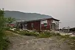 |
Woody Point | 49.5047 -57.913 |
4048 | Municipal Heritage Building, Structure or Land | 2002 | |||
| M | Edward J. Roberts House | 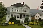 |
Woody Point | 49.5025 -57.9133 |
4052 | 1922 | Municipal Heritage Building, Structure or Land | 2002 | ||
| M | George and Jane Crocker House | 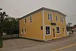 |
Woody Point | 49.5005 -57.9139 |
4040 | Municipal Heritage Building, Structure or Land | 2002 | |||
| M | Haliburton House |
|
Woody Point | 49.5033 -57.913 |
4049 | 1900 | Municipal Heritage Building, Structure or Land | 2002 | ||
| P | John William Roberts House | 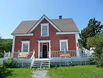 |
Woody Point | 49.5033 -57.9142 |
2190 | 1898 | Registered Heritage Structure | 2003 | ||
| M | Old Anglican Cemetery |
|
Woody Point | 49.4999 -57.9165 |
4035 | Municipal Heritage Building, Structure or Land | 2002 | |||
| M | Old Loft Restaurant/Jersey Room Crafts | 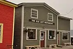 |
Woody Point | 49.5006 -57.9136 |
4032 | 1936 | Municipal Heritage Building, Structure or Land | 2002 | ||
| M | Prebble House |  |
Woody Point | 49.502 -57.9137 |
4051 | 1922 | Municipal Heritage Building, Structure or Land | 2002 | ||
| M | Roberts Store | 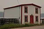 |
Woody Point | 49.5031 -57.913 |
4037 | Municipal Heritage Building, Structure or Land | 2002 | |||
| M | Walter F. Butt House |  |
Woody Point | 49.502 -57.9162 |
4050 | 1920 | Municipal Heritage Building, Structure or Land | 2002 |
Notes et références
- Niveau de la désignation: F: Fédéral, P: Provincial, M: Municipal
- (fr) Répertoire canadien des lieux patrimoniaux : Manuel de normes de documentation, Annexe A : Vocabulaires contrôlés, p.59-78
(en) Canadian Register of Historic Places: Documentation Standards Handbook, Appendix A: Controlled Vocabulary, p.57-75
Annexes
Liens externes
- « Lieux patrimoniaux du Canada »
- « Annuaire des désignations patrimoniales fédérales », sur Parcs Canada
- (en) « Property Search », sur Heritage Foundation of Newfoundland and Labrador
 Portail de Terre-Neuve-et-Labrador
  Portail des lieux patrimoniaux du Canada
Cet article est issu de Wikipedia. Le texte est sous licence Creative Commons - Attribution - Partage dans les Mêmes. Des conditions supplémentaires peuvent s'appliquer aux fichiers multimédias.