Milton Keynes (borough)
Le borough de Milton Keynes est une autorité unitaire située dans le comté du Buckinghamshire, en Angleterre. Son chef-lieu est la ville de Milton Keynes.
| Milton Keynes | |
| |
| Administration | |
|---|---|
| Pays | |
| Nation | |
| Région | Angleterre du Sud-Est |
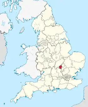
| Comté | Buckinghamshire |
| Statut | Autorité unitaire |
| Chef-lieu | Milton Keynes |
| Code ONS | 00HA |
| Démographie | |
| Population | 236 700 hab. (2011) |
| Densité | 767 hab./km2 |
| Géographie | |
| Superficie | 308,63 km2 |
Les paroisses
Paroisses urbaines
La zone urbaine du comté regroupe 33 % de sa superficie et abrite 90 % de sa population dont voici une liste non exhaustive des paroisses qui la compose :
- Bletchley and Fenny Stratford : Central Bletchley, Denbigh, Eaton Manor, Fenny Stratford, Water Eaton
- Bradwell : Bradwell, Bradwell Common, Bradwell village, Heelands, Rooksley
- Bradwell Abbey : Bradwell Abbey, Kiln Farm, Stacey Bushes, Two Mile Ash, Wymbush
- Broughton and Milton Keynes : Atterbury, Brook Furlong, Broughton, Fox Milne, Middleton (Milton Keynes Village), Milton Keynes village, Northfield, Oakgrove, Pineham
- Campbell Park : Campbell Park, Elfield Park, Fishermead, Newlands, Oldbrook, Springfield, Willen and Willen Lake, Winterhill
- Central Milton Keynes
- Great Linford : Blakelands, Conniburrow, Downs Barn, Downhead Park, Giffard Park, Great Linford, Neath Hill, Pennyland, Tongwell, Willen Park
- Kents Hill, Monkston and Brinklow: Brinklow, Kents Hill, Kingston, Monkston
- Loughton: Loughton, Loughton Lodge, Great Holm, the Bowl
- New Bradwell
- Shenley Brook End : Emerson Valley, Furzton, Kingsmead, Shenley Brook End, Snelshall, Tattenhoe, Tattenhoe Park, Westcroft
- Shenley Church End : Crownhill, Grange Farm, Hazeley, Medbourne, Oakhill, Oxley, Shenley Church End, Woodhill
- Simpson : Ashland, Simpson, West Ashland
- Stantonbury: Bancroft/Bancroft Park, Blue Bridge, Bradville, Linford Wood, Stantonbury, Stantonbury Fields
- Stony Stratford : Fullers Slade, Galley Hill, Stony Stratford
- Walton: Caldecotte, Old Farm Park, Tilbrook, Tower Gate, Walnut Tree, Walton, Walton Hall, Walton Park, Wavendon Gate
- West Bletchley : Bletchley Park, Church Green, Far Bletchley, Old Bletchley, West Bletchley, Whaddon (ward)
- Wolverton and Greenleys : Greenleys, Stonebridge, Wolverton, Old Wolverton
- Woughton : Beanhill, Bleak Hall, Coffee Hall, Eaglestone, Leadenhall, Netherfield, Peartree Bridge, Redmoor, Tinkers Bridge, Woughton on the Green, Woughton Park, Woughton village.
- Newport Pagnell se trouve à l'intérieur de la zone urbaine de Milton Keynes, tel que défini par la Office of National Statistics, mais en réalité est depuis 1967 en dehors de la « zone désignée » et est donc généralement admis comme distincts.
Paroisses rurales
La zone rurale couvre 66 % de la superficie du comté et regroupe 10 % de la population, dont voici la liste non exhaustive des paroisses qui la compose :
- Astwood
- Bow Brickhill
- Caldecote [sic], Castlethorpe, Chicheley, Clifton Reynes, Cold Brayfield
- Emberton
- Filgrave
- Gayhurst
- Hanslope, Hardmead, Haversham
- Lathbury, Lavendon, Little Brickhill, Little Linford, Long Street,
- Moulsoe
- Newton Blossomville, North Crawley
- Olney
- Ravenstone
- Sherington, Stoke Goldington,
- Tyringham
- Warrington, Weston Underwood, Woburn Sands
 Portail de l’Angleterre
Cet article est issu de Wikipedia. Le texte est sous licence Creative Commons - Attribution - Partage dans les Mêmes. Des conditions supplémentaires peuvent s'appliquer aux fichiers multimédias.