Rohr im Burgenland
Rohr im Burgenland est une commune autrichienne du district de Güssing dans le Burgenland.
| Rohr im Burgenland | ||||

| ||||
| Administration | ||||
|---|---|---|---|---|
| Pays | ||||
| Land | ||||
| District (Bezirk) |
District de Güssing | |||
| Code postal | A- | |||
| Indicatif | 43+ | |||
| Démographie | ||||
| Population | 380 hab. ([1]) | |||
| Densité | 45 hab./km2 | |||
| Géographie | ||||
| Coordonnées | 47° 07′ 04″ nord, 16° 09′ 54″ est | |||
| Altitude | 390 m |
|||
| Superficie | 840 ha = 8,4 km2 | |||
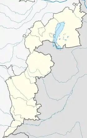
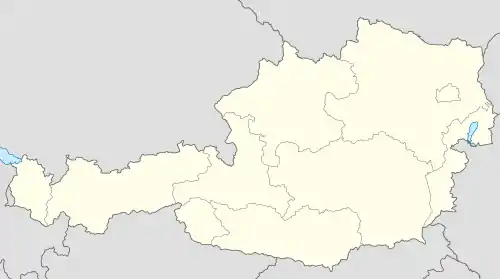
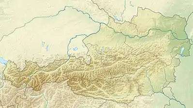
| Localisation | ||||
| Géolocalisation sur la carte : Burgenland
Géolocalisation sur la carte : Autriche
Géolocalisation sur la carte : Autriche
| ||||
Géographie
La commune de Rohr im Burgenland est située au sud du Burgenland. Rohr im Burgenland est son seul village, pendant que Haslich, Mitterbergen et Unterbergen sont les autres lieux habités dans la région.

Démographie
| Année | Pop. | ±% |
|---|---|---|
| 1869 | 475 | — |
| 1880 | 544 | +14,5% |
| 1890 | 626 | +15.1% |
| 1900 | 635 | +1,4% |
| 1910 | 625 | -1,6% |
| 1923 | 602 | -3,7% |
| 1934 | 579 | -3,8% |
| 1939 | 519 | -10,4% |
| 1951 | 457 | -11,9% |
| 1961 | 440 | -3,7% |
| 1971 | 397 | -9,8% |
| 1981 | 426 | +7,3% |
| 1991 | 378 | -11,3% |
| 2001 | 394 | +4,2% |
| 2006 | 395 | +0,3% |
| 2011 | 398 | +0,8% |
| 2017 | 387 | -2,8% |
| 2020[2] | 376 | -2,8% |
Notes et références
- (de) Cet article est partiellement ou en totalité issu de l’article de Wikipédia en allemand intitulé « Rohr im Burgenland » (voir la liste des auteurs).
- « Einwohnerzahl 1.1.2018 nach Gemeinden mit Status, Gebietsstand 1.1.2018 », Statistik Austria (en) (consulté le )
- (en) « NUTS 3 ordered by municpalities , area and population », statistik.at, (lire en ligne)
Cet article est issu de Wikipedia. Le texte est sous licence Creative Commons - Attribution - Partage dans les Mêmes. Des conditions supplémentaires peuvent s'appliquer aux fichiers multimédias.