Liste des lieux patrimoniaux du comté de Lunenburg
Cet article recense les lieux patrimoniaux du comté de Lunenburg en Nouvelle-Écosse inscrit au répertoire des lieux patrimoniaux du Canada, qu'ils soient de niveau provincial, fédéral ou municipal.
Liste
| [1] | Lieu patrimonial | Illustration | Municipalité | Adresse | Coordonnées | No | Constr. | Prot.[2] | Rec. | Notes |
|---|---|---|---|---|---|---|---|---|---|---|
| M | All Saints Anglican Church | 
|
Bayswater | 4122 Highway 329 | 44.4988 -64.0686 |
7008 | Municipally Registered Property | 2001 | ||
| M | Anglican Rectory |
|
Blandford | 4898 Highway 329 | 44.4939 -64.1095 |
9183 | Municipally Registered Property | 1995 | ||
| M | St. Barnabas Anglican Church |
|
Blandford | 4936 Highway 329 | 44.4965 -64.1093 |
11196 | Municipally Registered Property | 2008 | ||
| P | John Henry Ernst House |
|
Blockhouse | 222 Langille Settlement Road | 44.4488 -64.4321 |
3466 | 1800 | Provincially Registered Property | 1989 | |
| M | Saint Barnabas' Church |
|
Blue Rocks | 1396 Blue Rocks Road | 44.3562 -64.2425 |
5729 | 1886 | Municipally Registered Property | 1999 | |
| M | St. Paul's United Church |
|
Blue Rocks | 135 Stonehurst Road | 44.361 -64.2381 |
5752 | 1885 | Municipally Registered Property | 2005 | |
| M | The Fairview Inn |
|
Bridgewater | 25 Queen Street | 44.376 -64.5196 |
11972 | 1916 | Municipally Registered Property | 1996 | |
| M | Holy Trinity Anglican Church |
|
Bridgewater | 68 Alexandra Avenue | 44.3724 -64.5158 |
11932 | 1857 | Municipally Registered Property | 1995 | |
| M | Riverview Community Centre |
|
Bridgewater | 1153 King Street | 44.39 -64.5329 |
11901 | Municipally Registered Property | 1986 | ||
| M | Chester Train Station |
|
Chester | 20 Smith Road | 44.5471 -64.2452 |
7327 | Municipally Registered Property | 1992 | ||
| M | Chester United Baptist Church |
|
Chester | 84 King Street | 44.5403 -64.2413 |
9188 | Municipally Registered Property | 1991 | ||
| M | David Nauss House |
|
Chester | 255 Haddon Hill Road | 44.5561 -64.2533 |
8926 | Municipally Registered Property | 1992 | ||
| M | Gorman House |
|
Chester | 42 Pleasant Street | 44.5382 -64.2421 |
9190 | Municipally Registered Property | 1994 | ||
| M | Lavers House |
|
Chester | 192 Central Street | 44.5442 -64.2424 |
11145 | Municipally Registered Property | 2000 | ||
| M | Lordly House |
|
Chester | 133 Central Street | 44.3224 -64.1431 |
7237 | Municipally Registered Property | 1991 | ||
| M | Old Methodist Church |
|
Chester | 14 Main Street | 44.3229 -64.1419 |
7236 | Municipally Registered Property | 1991 | ||
| M | Quarter Deck |
|
Chester | 6 Queen Street | 44.3211 -64.1423 |
7020 | Municipally Registered Property | 1997 | ||
| M | Robinson House |
|
Chester | 78 Queen Street | 44.3224 -64.1423 |
6964 | 1902 | Municipally Registered Property | 1994 | |
| M | Samuel Prescott House |
|
Chester | 55 Central Street | 44.538 -64.2428 |
6963 | Municipally Registered Property | 1992 | ||
| M | St. Peter's Lutheran Church |
|
Chester | 5 Old Trunk Road No. 3 (Commons Road) | 44.5501 -64.2332 |
9180 | Municipally Registered Property | 2008 | ||
| M | St. Stephen's Anglican Church |
|
Chester | 60 Regent Street | 44.5415 -64.2423 |
11326 | 1840 | Municipally Registered Property | 2008 | |
| M | Taffrail Cottage |
|
Chester | 18 Queen Street | 44.3215 -64.1424 |
6966 | Municipally Registered Property | 1992 | ||
| M | Terrace Cottage |
|
Chester | 19 King Street | 44.5376 -64.242 |
6965 | Municipally Registered Property | 1992 | ||
| M | Zoé Vallé Library |
|
Chester | 63 Regent Street | 44.5413 -64.2423 |
7005 | Municipally Registered Property | 1991 | ||
| M | Backman Homestead |
|
Chester Basin | 5219 Highway 3 | 44.5692 -64.3008 |
15302 | Municipally Registered Property | 1991 | ||
| M | Calvin Eisnor Home |
|
Chester Basin | 92 Clayton Eisnor Road | 44.5656 -64.3002 |
8955 | Municipally Registered Property | 1992 | ||
| M | Corkum-Bezanson Home |
|
Chester Basin | 209 Middle River Road | 44.5741 -64.2815 |
9189 | Municipally Registered Property | 1992 | ||
| M | Countway Home |
|
Chester Basin | 12 Lower Grant Road | 44.5674 -64.291 |
15387 | Municipally Registered Property | 1994 | ||
| P | Eisenhauer House |
|
Chester Basin | 430 Borgels Point Road | 44.5497 -64.3042 |
6656 | Provincially Registered Property | 1996 | ||
| M | Manuels Inn |
|
Chester Basin | 17 Croft Road | 44.5662 -64.3115 |
8500 | Municipally Registered Property | 1992 | ||
| M | Oxner-Zinck House |
|
Chester Basin | 172 Highway 12 | 44.571 -64.3122 |
10632 | Municipally Registered Property | 1992 | ||
| M | Rafuse Hennigar Home |
|
Chester Basin | 759 Chester Grant Road | 44.6138 -64.3189 |
11495 | Municipally Registered Property | 1991 | ||
| M | Redeemer Lutheran Church |
|
Conquerall Bank | 1097 Highway 331 | 44.3613 -64.4571 |
5745 | 1863 | Municipally Registered Property | 1999 | |
| F | Phare et résidence combinés de East Ironbound |
|
East Ironbound | 44.4395 -64.0832 |
13073 | Recognized Federal Heritage Building | 2006 | |||
| M | St. George's Anglican Church |
|
East River | 7338 Highway No 329 | 44.5735 -64.1538 |
10929 | Heritage Conservation District | 2005 | ||
| P | Northwest United Baptist Church |
|
Fauxburg | 1609 Big Lots Road | 44.4137 -64.3676 |
6567 | 1820 | Provincially Registered Property | 2002 | |
| M | MacIsaac House |
|
Garden Lots | 19 Hospital Road | 44.3735 -64.2988 |
5746 | 1899 | Municipally Registered Property | 1999 | |
| M | Union Church of Indian Point |
|
Indian Point | 181 Indian Point Road | 44.4604 -64.3123 |
5732 | 1904 | Municipally Registered Property | 2004 | |
| F | Lieu historique national du Canada du Fort-Sainte-Marie-de-Grâce |
|
LaHave | 44.2883 -64.3514 |
13572 | 1632 | National Historic Site of Canada | 1924 | ||
| M | LaHave Islands Marine Museum |
|
LaHave Island | 100 LaHave Islands Road | 44.2327 -64.3704 |
5748 | 1913 | Municipally Registered Property | 2002 | |
| M | St. John Evangelist Anglican Church |
|
LaHave Island | 388 LaHave Islands Road; Bell Island | 44.2255 -64.3589 |
5683 | 1903 | Municipally Registered Property | 1997 | |
| M | 112-118 Lincoln Street | 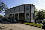 |
Lunenburg | 112-118 Lincoln Street | 44.3778 -64.3139 |
1667 | 1907 | Municipally Registered Property | 1993 | |
| M | 207 Montague Street |
|
Lunenburg | 207 Montague Street | 44.3763 -64.3066 |
1655 | 1889 | Municipally Registered Property | 1992 | |
| M | 49 Cornwallis Street | 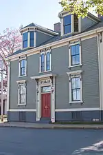 |
Lunenburg | 49 Cornwallis Street | 44.3786 -64.3122 |
1609 | 1829 | Municipally Registered Property | 1992 | |
| M | 56 Dufferin Street | 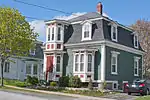 |
Lunenburg | 56 Dufferin Street | 44.3797 -64.3186 |
2005 | 1888 | Municipally Registered Property | 2003 | |
| M | 60 Dufferin Street | 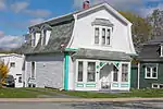 |
Lunenburg | 60 Dufferin Street | 44.3798 -64.3187 |
1809 | 1888 | Municipally Registered Property | 1998 | |
| M | 78 Fox Street | 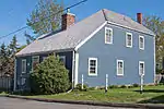 |
Lunenburg | 78 Fox Street | 44.3788 -64.3115 |
1654 | 1818 | Municipally Registered Property | 1996 | |
| M | Allan R. Morash House | 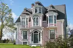 |
Lunenburg | 43 York Street | 44.3797 -64.3128 |
2068 | 1888 | Municipally Registered Property | 1998 | |
| M | Ashlea House | 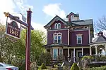 |
Lunenburg | 42 Falkland Street | 44.3774 -64.3187 |
2065 | 1890 | Municipally Registered Property | 1989 | |
| M | Bailly House | 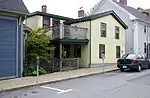 |
Lunenburg | 134 Pelham Street | 44.3767 -64.3088 |
1533 | 1790 | Municipally Registered Property | 1990 | |
| M | Boscawen Inn |
|
Lunenburg | 150 Cumberland Street | 44.3722 -64.3089 |
12624 | Municipally Registered Property | 1983 | ||
| M | Captain Angus Walters House |
|
Lunenburg | 37 Tannery Road | 44.375 -64.3189 |
2692 | 1915 | Municipally Registered Property | 2000 | |
| M | Captain William Boehner House | 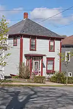 |
Lunenburg | 36 Dufferin Street | 44.3792 -64.318 |
1799 | 1890 | Municipally Registered Property | 1997 | |
| M | Captain William Smith House | 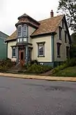 |
Lunenburg | 361 Lincoln Street | 44.3771 -64.3061 |
2004 | 1880 | Municipally Registered Property | 1998 | |
| M | Central United Church | 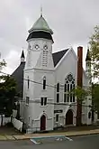 |
Lunenburg | 136 Cumberland Street | 44.3775 -64.309 |
2066 | 1885 | Municipally Registered Property | 1997 | |
| M | Charles Smith House | 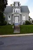 |
Lunenburg | 321 Lincoln Street | 44.3773 -64.3079 |
1672 | 1877 | Municipally Registered Property | 2000 | |
| M | Daniel Rudolf House |  |
Lunenburg | 325 Lincoln Street | 44.3773 -64.3077 |
2136 | 1886 | Municipally Registered Property | 1999 | |
| F | Église anglicane St. John |  |
Lunenburg | 2 Cumberland Street | 44.3781 -64.3115 |
12344 | 1763 | LHN | 1994 | [3] |
| M | Geldert House |
|
Lunenburg | 205 York Street | 44.3789 -64.3056 |
1635 | 1890 | Municipally Registered Property | 1991 | |
| M | Henry Neil Property |  |
Lunenburg | 242 Lincoln Street | 44.3772 -64.3104 |
1798 | 1826 | Municipally Registered Property | 1993 | |
| M | James D. Eisenhauer House |  |
Lunenburg | 18 Falkland Street | 44.3782 -64.3178 |
2767 | 1862 | Municipally Registered Property | 1998 | |
| M | James Holland House |
|
Lunenburg | 230 Pelham Street | 44.376 -64.3043 |
2693 | 1897 | Municipally Registered Property | 1998 | |
| M | James Hunt House |
|
Lunenburg | 331 Lincoln Street | 44.3773 -64.3074 |
2687 | 1876 | Municipally Registered Property | 1999 | |
| M | John B. Young House | 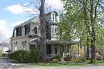 |
Lunenburg | 21 Falkland Street | 44.3778 -64.3173 |
2051 | 1890 | Municipally Registered Property | 1990 | |
| M | Jost House | 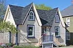 |
Lunenburg | 77 Fox Street | 44.379 -64.3115 |
1640 | 1860 | Municipally Registered Property | 2000 | |
| M | Kaulbach House |
|
Lunenburg | 75 Pelham Street | 44.3769 -64.3114 |
1414 | 1890 | Municipally Registered Property | 1988 | |
| M | Knaut-Rhuland House | 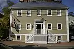 |
Lunenburg | 125 Pelham Street | 44.3769 -64.309 |
1786 | 1813 | Municipally Registered Property | 1983 | |
| P | Knaut-Rhuland House |
|
Lunenburg | 125 Pelham Street | 44.3769 -64.309 |
6488 | 1794 | Provincially Registered Property | 1989 | |
| P | Lennox Tavern |
|
Lunenburg | 69 Fox Street | 44.379 -64.3118 |
3529 | 1791 | Provincially Registered Property | 1992 | |
| M | Lennox Tavern |
|
Lunenburg | 69 Fox Street | 44.379 -64.3118 |
1299 | 1818 | Municipally Registered Property | 1995 | |
| M | Lewis A. Hirtle Photography Shop |
|
Lunenburg | 183 Lincoln Street | 44.3775 -64.3119 |
1670 | 1906 | Municipally Registered Property | 1993 | |
| F | Lieu historique national du Canada de l'Académie-de-Lunenburg |  |
Lunenburg | 101 Kaulback Street | 44.3693 -64.2966 |
13179 | 1895 | National Historic Site of Canada | 1983 | |
| F | Lieu historique national du Canada de l'Arrondissement-Historique-du-Vieux-Lunenburg |
|
Lunenburg | Bluenose Drive, Lunenburg Harbour | 44.3779 -64.3096 |
4256 | 1991 | National Historic Site of Canada | 1991 | |
| M | Lunenburg Academy | 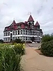 |
Lunenburg | 101 Kaulback Street | 44.3802 -64.3137 |
1517 | 1895 | Municipally Registered Property | 1983 | |
| P | Lunenburg Academy | |
Lunenburg | 101 Kaulback Street | 44.3802 -64.3137 |
6483 | 1895 | Provincially Registered Property | 1984 | |
| M | Lunenburg Inn | 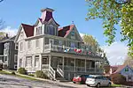 |
Lunenburg | 26 Dufferin Street | 44.3789 -64.3178 |
2033 | 1893 | Municipally Registered Property | 1990 | |
| M | Lunenburg Old Town Heritage Conservation District |
|
Lunenburg | Old Town | 44.378 -64.3098 |
2253 | Heritage Conservation District | 2000 | ||
| M | Lunenburg Town Hall | 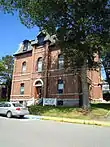 |
Lunenburg | 119 Cumberland Street | 44.378 -64.3098 |
1611 | 1893 | Municipally Registered Property | 1996 | |
| F | Maison Knaut-Rhuland | |
Lunenburg | 125, Pelham Street | 44.3768 -64.3091 |
8077 | 1793 | LHN | 2002 | |
| M | Mayner House | 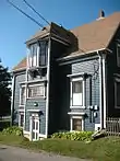 |
Lunenburg | 185 Townsend Street | 44.3781 -64.3066 |
1575 | 1883 | Municipally Registered Property | 1996 | |
| M | McKittrick House |  |
Lunenburg | 48 Dufferin Street | 44.3795 -64.3188 |
1789 | 1889 | Municipally Registered Property | 1991 | |
| M | McLachlan House |  |
Lunenburg | 306 Lincoln Street | 44.3769 -64.3086 |
12625 | Municipally Registered Property | 1983 | ||
| M | Mizpah Cottage |
|
Lunenburg | 75 Dufferin Street | 44.3799 -64.3199 |
10837 | Municipally Registered Property | 1992 | ||
| M | Morash Emporium |
|
Lunenburg | 55 Montague Street | 44.3769 -64.3122 |
2022 | 1876 | Municipally Registered Property | 1990 | |
| M | Naas House |
|
Lunenburg | 8 Tannery Road | 44.3758 -64.32 |
2057 | 1850 | Municipally Registered Property | 1995 | |
| M | Old New Town School |  |
Lunenburg | 17 Tannery Road | 44.3759 -64.319 |
2688 | 1883 | Municipally Registered Property | 2000 | |
| M | Robert Herman House |
|
Lunenburg | 201 York Street | 44.3789 -64.3058 |
2694 | 1893 | Municipally Registered Property | 2000 | |
| M | Samuel Herman House |  |
Lunenburg | 56 Broad Street | 44.3792 -64.32 |
1653 | 1906 | Municipally Registered Property | 2000 | |
| M | Selig House |  |
Lunenburg | 74 Cornwallis Street | 44.3795 -64.3115 |
2684 | 1835 | Municipally Registered Property | 1998 | |
| M | Smith House |  |
Lunenburg | 58 Hopson Street | 44.3783 -64.3067 |
1529 | 1890 | Municipally Registered Property | 1991 | |
| M | Solomon House |
|
Lunenburg | 69 Townsend Street | 44.3802 -64.3137 |
1549 | 1797 | Municipally Registered Property | 1983 | |
| M | St. Andrew's Presbyterian Church |
|
Lunenburg | 111 Townsend Street | 44.3773 -64.3074 |
1639 | 1828 | Municipally Registered Property | 1990 | |
| P | St. John's Anglican Church |  |
Lunenburg | Duke Street | 44.3782 -64.3111 |
5449 | 1761 | Provincially Registered Property | 1983 | [4] |
| M | St. John's Anglican Church Rectory |
|
Lunenburg | 58 Townsend Street | 44.3783 -64.3128 |
2009 | 1816 | Municipally Registered Property | 1989 | |
| M | St. John's Parish Hall |
|
Lunenburg | 65 Cumberland Street | 44.3783 -64.3123 |
2014 | 1775 | Municipally Registered Property | 1989 | |
| M | St. Norbert's Roman Catholic Church |  |
Lunenburg | 121 York Street | 44.3792 -64.3096 |
2135 | 1839 | Municipally Registered Property | 1999 | |
| M | Walters Blacksmith Shop |
|
Lunenburg | 2 Kempt Street | 44.3761 -64.3058 |
2056 | 1902 | Municipally Registered Property | 1993 | |
| M | William Godley House | 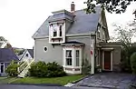 |
Lunenburg | 205 Cumberland Street | 44.3776 -64.3059 |
2060 | 1880 | Municipally Registered Property | 1998 | |
| M | Wilson House | 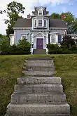 |
Lunenburg | 315 Lincoln Street | 44.3772 -64.3083 |
1936 | 1879 | Municipally Registered Property | 1989 | |
| M | Wolff House | 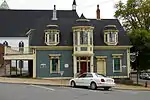 |
Lunenburg | 28 King Street | 44.3774 -64.3094 |
2032 | 1876 | Municipally Registered Property | 1990 | |
| M | Young House |
|
Lunenburg | 95 Montague Street | 44.3767 -64.3106 |
2690 | 1876 | Municipally Registered Property | 2000 | |
| M | Zion Evangelical Lutheran Church | 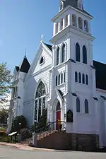 |
Lunenburg | 65 Fox Street | 44.3792 -64.3121 |
1666 | 1891 | Municipally Registered Property | 1992 | |
| P | Zion Lutheran Church |
|
Lunenburg | 65 Fox Street | 44.3791 -64.3122 |
6281 | 1891 | Provincially Registered Property | 1996 | |
| M | Zwicker House | 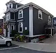 |
Lunenburg | 13-15 King Street | 44.3771 -64.31 |
2171 | 1836 | Municipally Registered Property | 1989 | |
| M | 121 Edgewater Street |
|
Mahone Bay | 121 Edgewater Street | 44.4524 -64.381 |
11852 | Municipally Registered Property | 2001 | ||
| M | 17 Aberdeen Street |
|
Mahone Bay | 17 Aberdeen Street | 44.4496 -64.3835 |
16272 | Municipally Registered Property | 1996 | ||
| M | 328 Main Street |
|
Mahone Bay | 328 Main Street | 44.4509 -64.3902 |
12035 | Municipally Registered Property | 1989 | ||
| M | 38 School Street |
|
Mahone Bay | 38 School Street | 44.447 -64.3806 |
11845 | Municipally Registered Property | 2001 | ||
| M | 578 Main Street |
|
Mahone Bay | 578 Main Street | 44.4488 -64.379 |
11861 | Municipally Registered Property | 1989 | ||
| M | 674 Main Street |
|
Mahone Bay | 674 Main Street | 44.4471 -64.3752 |
12066 | Municipally Registered Property | 1998 | ||
| M | 680 Main Street |
|
Mahone Bay | 680 Main Street | 44.447 -64.375 |
12096 | Municipally Registered Property | 1990 | ||
| M | 77 Edgewater Street |
|
Mahone Bay | 77 Edgewater Street | 44.4508 -64.3801 |
11801 | Municipally Registered Property | 1998 | ||
| M | 97 Edgewater Street |
|
Mahone Bay | 97 Edgewater Street | 44.4514 -64.3806 |
12581 | Municipally Registered Property | 1989 | ||
| P | Alexander Kedy House |
|
Mahone Bay | 237-249 Edgewater Street | 44.4558 -64.3789 |
16205 | Provincially Registered Property | 1987 | ||
| M | Bayview Cemetery |
|
Mahone Bay | Edgewater Street, corner of Clearland | 44.4534 -64.3812 |
12008 | Municipally Registered Property | 1991 | ||
| M | St. James' Anglican Church |
|
Mahone Bay | 65 Edgewater Street | 44.4505 -64.38 |
11975 | 1887 | Municipally Registered Property | 1994 | |
| M | St. John's Evangelical Lutheran Church | 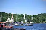 |
Mahone Bay | 89 Edgewater Street | 44.4512 -64.3804 |
12058 | 1869 | Municipally Registered Property | 1996 | |
| M | Trinity United Church |
|
Mahone Bay | 101 Edgewater Street | 44.4517 -64.3808 |
12095 | Municipally Registered Property | 2001 | ||
| M | United Baptist Church, Mahone Bay |
|
Mahone Bay | 56 Maple Street | 44.4468 -64.3795 |
12097 | 1875 | Municipally Registered Property | 1996 | |
| M | Christ Church Anglican Church of Canada |
|
Maitland | 455 Northfield Road | 44.4304 -64.4798 |
5750 | 1866 | Municipally Registered Property | 2001 | |
| M | Wecob |
|
Marriotts Cove | 24 Wake Up Hill Rd | 44.557 -64.2706 |
15301 | Municipally Registered Property | 1991 | ||
| P | Wecob |
|
Marriotts Cove | Wake Up Hill Road | 44.5571 -64.2702 |
7423 | Provincially Registered Property | 1988 | ||
| M | Saint Mark's Evangelical Lutheran Church |
|
Middle New Cornwall | 1231 Back Cornwall Road | 44.5034 -64.4798 |
5751 | 1863 | Municipally Registered Property | 2003 | |
| M | Countway Mosher Home |
|
Middle River | 4956 Highway 3 | 44.5652 -64.2853 |
9086 | Municipally Registered Property | 1991 | ||
| M | Christ Anglican Church |
|
New Ross | 4 Forties Road | 44.7367 -64.4592 |
10576 | Municipally Registered Property | 1992 | ||
| M | Christ Anglican Church Rectory |
|
New Ross | 10 Forties Road | 44.7366 -64.4595 |
10498 | Municipally Registered Property | 1997 | ||
| M | Larder Home |
|
New Ross | 4541 Highway 12 | 44.7239 -64.456 |
15303 | Municipally Registered Property | 2008 | ||
| M | Lincoln Meister House |
|
New Ross | 4865 Highway 12 | 44.7398 -64.4578 |
10704 | Municipally Registered Property | 1994 | ||
| M | Rosebank Cottage |
|
New Ross | Ross Farm Museum; 4568 Highway 12 | 44.7254 -64.4569 |
8748 | Municipally Registered Property | 1992 | ||
| M | Saint Andrews Presbyterian Church | 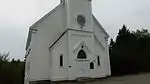 |
Rose Bay | 3483 Highway 332 | 44.2986 -64.3061 |
5714 | 1890 | Municipally Registered Property | 2001 | |
| M | St. Matthew's Evangelical Lutheran Church |
|
Rose Bay | 3472 No. 332 Highway | 44.2984 -64.3062 |
5684 | 1897 | Municipally Registered Property | 1998 | |
| M | Simpsons Corner Union Church |
|
Simpsons Corner | 1315 Highway 208 | 44.5405 -64.7815 |
5731 | 1897 | Municipally Registered Property | 2002 |
Notes et références
- Niveau de la désignation: F: Fédéral, P: Provincial, M: Municipal
- (fr) Répertoire canadien des lieux patrimoniaux : Manuel de normes de documentation, Annexe A : Vocabulaires contrôlés, p.59-78
(en) Canadian Register of Historic Places: Documentation Standards Handbook, Appendix A: Controlled Vocabulary, p.57-75 - Inscrit bien provincial en 1983 (St. John's Anglican Church)
- Désignée lieu historique national en 1994 (Église anglicane St. John)
Annexes
Articles connexes
Liens externes
Pour l'ensemble des points mentionnés sur cette page : voir sur OpenStreetMap (aide) ou télécharger au format KML (aide).
- « Lieux patrimoniaux du Canada »
- « Annuaire des désignations patrimoniales fédérales », sur Parcs Canada
- (en) « Nova Scotia Register of Historic Places », sur The Nova Scotia Historic Places Initiative
 Portail des lieux patrimoniaux du Canada
  Portail de la Nouvelle-Écosse
Cet article est issu de Wikipedia. Le texte est sous licence Creative Commons - Attribution - Partage dans les Mêmes. Des conditions supplémentaires peuvent s'appliquer aux fichiers multimédias.